Spatial data is information that describes the position, shape, size, or spatial relationship of an object or event. It can represent a store as a point, a road as a line, a trade area as a polygon, or population density as a grid.
Its value goes beyond displaying information on a map. Spatial data allows businesses to measure distance, proximity, overlap, movement, density, and other relationships that ordinary rows and columns cannot easily explain.
A sales table may show that Store A performs better than Store B. Add spatial context, and the analysis can show whether Store A has stronger foot traffic, better access, fewer competitors, or a larger trade area.
Key Takeaway
- Spatial data describes location, shape, extent, attributes, time, and relationships between places or objects.
- Geospatial data is a type of spatial data that specifically relates information to locations on Earth.
- Vector data represents discrete objects such as stores, roads, and trade areas, while raster data represents continuous surfaces such as population density.
- Spatial relationships such as distance, proximity, overlap, movement, and connectivity reveal patterns that ordinary tabular data cannot.
- Combining places, people, mobility, roads, trade areas, and internal business data creates stronger spatial context for decisions.
- Spatial data quality depends on positional accuracy, attribute accuracy, completeness, freshness, resolution, consistency, and coverage.
- Spatial analysis turns raw location data into useful inputs for site selection, market planning, targeting, logistics, forecasting, and other business decisions.
Spatial Data vs. Geospatial Data
Spatial data and geospatial data are closely related, but they are not exactly the same.
| Spatial data | Geospatial data |
| Describes position, shape, distance, or relationships in any spatial environment | Describes spatial information tied specifically to locations on Earth |
| Can exist in physical or abstract spaces | Uses geographic coordinates or Earth-based reference systems |
| Example: coordinates of objects inside a warehouse | Example: latitude and longitude of retail stores |
In simple terms, geospatial data is a type of spatial data.
For most business applications involving stores, roads, customers, trade areas, mobility, or markets, the spatial data being analyzed is also geospatial because it relates to real-world locations on Earth.
For a deeper look at geographic datasets and their applications, see geospatial data.
What Makes Data Spatial?
A useful spatial record usually contains more than a coordinate.
Four components help turn a location into something that can be analyzed.
Geometry
Geometry describes where an object exists and what form it takes.
A store may be represented as a point. A road can be a line. A trade area may be represented as a polygon.
Attributes
Attributes describe the object itself.
For a retail location, these may include:
- Brand
- Category
- Address
- Store status
- Opening hours
- Building size
Two stores can have similar coordinates or locations but very different business characteristics because of their attributes.
Time
Spatial conditions change.
A store may open or close. Traffic can rise on weekends. Visitor patterns can shift over several months. A neighborhood can gain new businesses or lose existing ones.
Adding time allows teams to understand not only where something happened, but when that spatial pattern was true.
Spatial Relationships
Relationships explain how one location interacts with another.
A store may be:
- 0.8 miles from a competitor
- inside a particular trade area
- close to a highway
- surrounded by complementary businesses
- overlapping with an existing store’s catchment
These relationships often create more business value than the coordinates alone.
The Two Main Spatial Data Models
Most spatial data is represented using vector or raster models.
Vector Data
Vector data represents individual objects using points, lines, and polygons.
| Geometry | Example |
| Point | Store, restaurant, ATM |
| Line | Road, railway, delivery route |
| Polygon | Trade area, ZIP code, property parcel |
Vector data works well when individual objects or boundaries need to be identified precisely.
POI data is a common business example. A store can be represented by coordinates and enriched with information such as brand, category, status, and address.
Raster Data
Raster data divides an area into a grid of cells or pixels. Each cell contains a value.
Common examples include:
- Satellite imagery
- Elevation
- Land cover
- Temperature
- Population density
Raster data works well for conditions that vary continuously across an area.
| Vector | Raster | |
| Structure | Points, lines, polygons | Grid cells |
| Best for | Individual objects | Continuous patterns |
| Retail example | Store locations | Population density |
| Main strength | Precise objects and boundaries | Area-wide patterns |
Spatial Relationships Create the Real Value
Knowing where something is only answers the first question.
Spatial analysis becomes more useful when locations are compared with each other.
Distance
How far is the nearest competitor?
Proximity
Which businesses are within one mile of a candidate site?
Containment
Which customers or stores fall inside a trade area?
Intersection
Where do two sales territories or catchments overlap?
Connectivity
Which roads or routes connect customers with a location?
Movement
Where are people traveling from, and which places do they visit?
Spatial databases are designed to support these kinds of operations. Oracle Spatial includes capabilities for proximity, containment, routing, geometry, and other location-based analysis.
| Spatial relationship | Business question |
| Distance | How close is the nearest competitor? |
| Proximity | What businesses surround this site? |
| Containment | Which customers fall inside this market? |
| Overlap | How much do two store catchments overlap? |
| Density | Where are businesses clustering? |
| Movement | Where do visitors come from? |
| Connectivity | How easily can customers reach the site? |
Spatial data does more than tell you where something is. It shows how locations relate to one another.
One Spatial Layer Is Rarely Enough
A map of store locations shows where stores exist. It does not explain why one location performs better than another.
More context appears when multiple layers are connected.
Places
Stores, competitors, restaurants, offices, transit hubs, and other physical locations describe the surrounding commercial environment.
People
People data adds demographic, household, and audience context to geographic markets.
Mobility
Aggregated movement signals can show where activity occurs, how visitation changes, and where visitors originate.
Roads and Accessibility
Road networks, travel times, transit options, and physical barriers affect how easily customers can reach a location.
Internal Business Data
Sales, transactions, store performance, CRM records, and operational data connect spatial conditions with business outcomes.
A single layer describes one part of a market. Combining layers helps explain how the market actually works.
Spatial Data vs. Ordinary Tabular Data
Traditional business data can show what happened.
Consider two stores:
| Store | Annual Sales |
| Store A | $4.0M |
| Store B | $2.8M |
The table shows the performance gap but does not explain what may be contributing to it.
Spatial context can add questions such as:
- Does Store A have stronger surrounding foot traffic?
- Is Store B closer to several competitors?
- Does one store draw from a larger trade area?
- Is customer access easier at one location?
- Are nearby neighborhoods growing differently?
Spatial data turns which location performs better into what about the location may explain the difference.
Where Does Spatial Data Come From?
Spatial datasets can come from many sources.
Common sources include:
- GPS
- Satellite imagery
- Aerial imagery
- Mobile devices
- IoT sensors
- Road networks
- Government boundaries
- Surveys
- Business listings
- Property records
Different sources answer different questions.
Satellite imagery can reveal physical changes across an area. POI data shows where businesses and other places exist. Mobility data adds context about how activity changes across locations.
The source should match the decision being made.
Common Spatial Data Formats
Spatial information also needs to be stored in formats that databases, analytics tools, and mapping systems can use.
| Format | Common use |
| GeoJSON | APIs and web mapping |
| Shapefile | Traditional GIS workflows |
| GeoTIFF | Raster and satellite imagery |
| KML | Geographic visualization |
| CSV + coordinates | Simple point datasets |
| GeoParquet | Large analytical datasets |
Format affects how easily data can be moved and analyzed.
But format alone says little about whether the underlying dataset is accurate or useful.
Spatial Data Quality Is More Than Coordinate Accuracy
A location can have precise coordinates and still contain poor information.
Several dimensions affect spatial data quality.
Positional Accuracy
Is the object actually where the coordinates place it?
Attribute Accuracy
Are its category, brand, status, and other properties correct?
Completeness
Are important locations or geographic areas missing?
Freshness
Has the business closed, moved, or changed?
Resolution
Is the geographic detail precise enough for the intended decision?
Temporal Consistency
Were the layers being compared measured during similar periods?
Coverage
Does the dataset provide consistent information across the required markets?
A precise coordinate attached to stale or incorrect business information is still bad spatial data.
What Business Questions Can Spatial Data Answer?
Spatial data supports decisions across many industries.
Retail and Restaurants
Teams can compare candidate sites, competitors, trade areas, foot traffic, and surrounding demand.
Advertising
Marketers can understand where relevant audiences and real-world activity are concentrated.
Commercial Real Estate
Analysts can compare accessibility, nearby businesses, demographics, traffic, and market conditions.
Logistics
Spatial data can support routing, facility placement, delivery zones, and network planning.
Financial Services
Banks can analyze branch coverage, merchant density, customer markets, and underserved areas.
Telecom
Network teams can compare infrastructure with geographic patterns of demand.
The business question changes, but the underlying process is similar: connect several spatial layers around a location, route, or market.
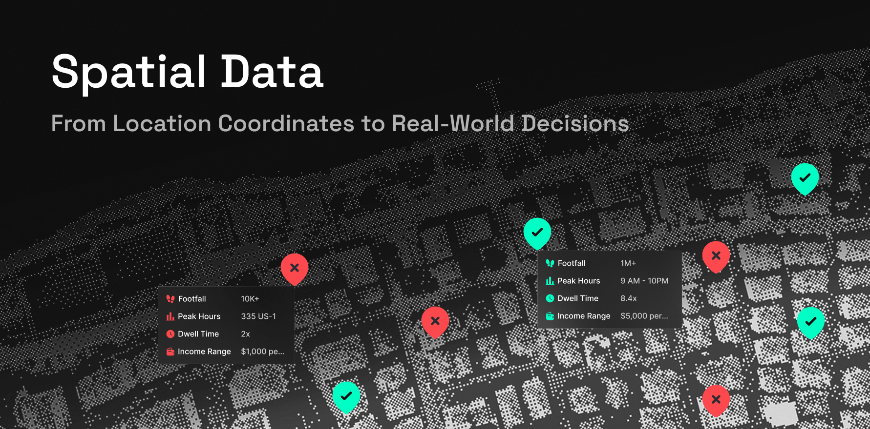
Example: From Coordinates to a Site-Selection Decision
Suppose a retailer is evaluating three candidate stores.
The first dataset contains only their coordinates.
That identifies where the sites are, but it does not provide enough information to choose one.
Add more spatial layers:
- Competitors: Which competing stores surround each candidate?
- People: Where is the target audience concentrated?
- Mobility: Which locations have stronger real-world activity?
- Trade areas: Where could customers realistically come from?
- Existing stores: Which candidate overlaps with the current network?
Candidate A may have the strongest traffic and audience fit. Spatial analysis may also reveal that its trade area overlaps heavily with an existing store.
A location that looks strongest on one layer can become weaker once the other spatial relationships are considered.
Spatial Data, Spatial Analysis, and Location Intelligence
These concepts represent different stages of the same workflow.
| Stage | Purpose |
| Spatial data | Describe geographic objects and signals |
| Spatial analysis | Measure relationships and patterns |
| Location intelligence | Apply those findings to a business decision |
For example:
Spatial data: Store and competitor coordinates
→ Spatial analysis: Measure competitor density and catchment overlap
→ Location intelligence: Prioritize the stronger expansion market
Location intelligence connects spatial analysis with decisions such as expansion, targeting, forecasting, and network planning.
Spatial Data Is Moving Into the Modern Data Stack
Spatial analysis no longer needs to remain inside dedicated mapping software.
Modern databases, cloud warehouses, APIs, analytics environments, and machine learning workflows increasingly support spatial information directly.
CARTO describes how spatial workloads can now operate across modern cloud data platforms.
This makes it easier to combine geography with existing customer, product, revenue, and operational data.
Spatial data can therefore become another analytical dimension rather than a separate mapping workflow.
How Factori Supports Spatial Data Workflows
Factori provides real-world datasets across Places, Mobility, People, Audiences, Events, and other market signals.
Teams can connect these datasets with internal business data to analyze proximity, visitation, competition, trade areas, audience concentration, market activity, and other spatial relationships.
The data can support analytics, APIs, data warehouses, and AI workflows across site selection, market analysis, targeting, forecasting, and other location-based decisions.
Conclusion
Spatial data starts with geometry, but its usefulness comes from context.
Coordinates identify locations. Attributes describe them. Time shows how conditions change. Spatial relationships reveal how those locations interact with the world around them.
When these layers are accurate, current, and connected, geography becomes measurable alongside revenue, customers, products, and time. Spatial data then becomes more than something displayed on a map. It becomes another source of evidence for business decisions.
FAQs
What is spatial data?
Spatial data is information that describes the position, shape, extent, or spatial relationship of an object or event. It can represent points, lines, polygons, grids, routes, and other spatial features.
What are the two main types of spatial data?
The two main spatial data models are vector and raster. Vector data represents discrete objects using points, lines, and polygons. Raster data represents an area as a grid of cells.
What is the difference between spatial data and geospatial data?
Spatial data is the broader term for information about position and relationships in space. Geospatial data is spatial information referenced specifically to locations on Earth.
What is an example of spatial data?
A retail store represented by latitude and longitude is a simple example. The record can also contain attributes such as brand, category, trade area, nearby competitors, and visit patterns.
How is spatial data used in business?
Businesses use spatial data for site selection, market analysis, logistics, advertising, commercial real estate, territory planning, network optimization, forecasting, and other decisions where geography affects performance.